Live Navigation Active
Outdoor Navigation Platform

Be the
Captain,
Anywhere

Navigate any terrain. Command the wild — with the precision tools of a captain and the weight of nothing.

Scroll
Navigate Your World

Live Map
Editions

Two precision map platforms — built for mountaineers and global explorers. Accept our terms to launch your expedition.

Mountaineering Edition

Switzerland

Alpine precision mapping for the Swiss mountains. High-detail topography, alpine trails, and 3D terrain for the most demanding terrain on Earth.

Launch Map
CH
Global Edition

Global

Worldwide coverage. Navigate any region on the planet with offline-capable maps, satellite imagery, and real-time weather overlay.

Launch Map
GL
Mobile Application

The Field
Command
App

With OutdoorCaptain you have the tools to navigate your surroundings like a captain. Fast. Offline. No bullshit — so you can make decisions faster when it matters.

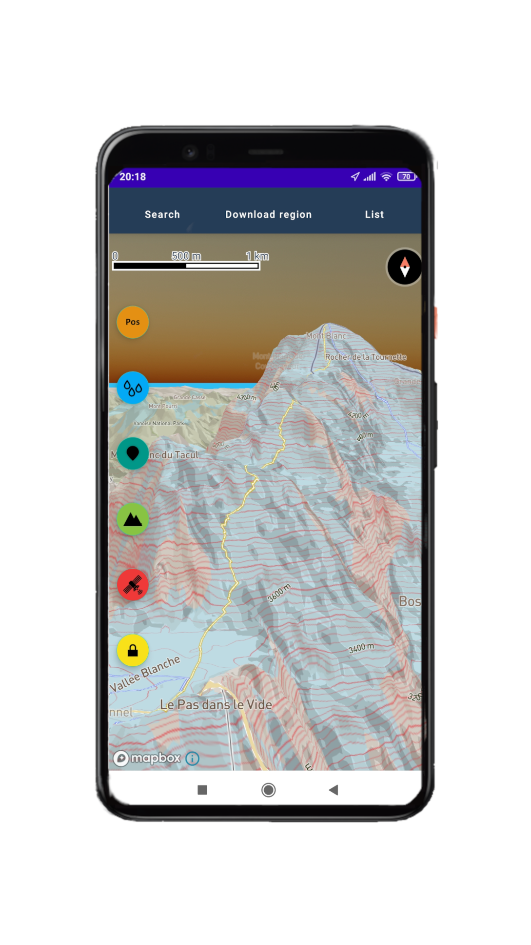
  • Real-time GPS localization with automatic map orientation
  • 3D satellite imagery and photorealistic terrain
  • Offline topographic maps — zero signal required
  • GPX route recording and display — stays on device
  • Live weather radar overlay
  • Target finder for low-visibility and difficult terrain
  • Offroad route planning beyond paved roads
Available for Android
OutdoorCaptain mobile app showing 3D topographic terrain view
Professional Data Products

Precision
Elevation
Models

The OutdoorCaptain team produces and sells ultra-high precision Digital Elevation Models — from targeted regional surveys to full country-scale datasets. Built for engineers, researchers, civil planners, and expedition professionals who need the ground truth.

50 cm
Max Resolution
2 m
Standard Resolution
25 km²
Min. Coverage Area
Country
Maximum Scale
Request a Quote Custom coverage & resolution available
N E S W
± 50cm
Horizontal
Accuracy